Thursday, August 02, 2018

The magnificent Western Pond

One of our favourite Newfoundland 'linguisms' is  the use of "pond" for what we ourselves know as "lake". Western Pond was formed by glacial action. The sheer weight of the ice during the great ice ages was such that the glaciers that formed Western Pond and the surrounding valleys once ended up flowing to where the sea now is. When the ice melted and the weight came off the land level rose and the Pond was closed off from the sea. These days Western Brook Pond flows out to the sea, north of where the track leads in to the Pond. The land rises to maybe 10 metres above sea level in places.

On the first afternoon of our trip we just walked in the 3 kilometres to the jetty in the late afternoon. There is a now a track that could take a car, but the only vehicles we saw were small utilities like golf carts that carried the workers in to work on the boats and the tourist building, which serves meals, sells memorabilia, and sells boat trip tickets.


The second day we were on the boat a little after 10am. The trip took around two and a half hours, running to the end of the pond, with stops at standout points. The return trip was quicker, and offered a chance to get photos of sights that were overpowered by the morning sun on the way up. It was easy to feel very small in the scale of things.


Rocky Harbour and the Lobster Cove Lighthouse

After finishing teaching the second course for the summer in Steady Brook we set off in the afternoon to see the spectacular Western Pond. This involved driving about 120 kms  to the coast north west of where we were working, and then walking 3 kilometres to where the tourist boats leave from. Not having been there before we weren't sure how much could actually be seen from the end of the walk, and whether or not it would be necessary to take the boat trip.

By the time we reached the park headquarters to buy our park entry pass the last boat trip was already leaving, 50 kms ahead of where we were. So we bought the passes and decided to walk in and see what we could see. Upon arriving at the jetty and tourist building we knew immediately that we would be taking a boat trip the next day.

With the sun not setting until 9pm and it being only 6pm by the time we got back to the car we still had time to look at some local scenery, but first had to find a place to stay. The first couple of places we rang told us they were booked out until the end of August. We struck lucky with a cancellation back in Rocky Harbour, so we drove back, checked in, drove to the waterfront, had a meal sitting in the car watching the sea, and then headed off, blind, to see what we could find.

Michele had wanted to see the Lobster Cove Lighthouse, but we hadn't much of an idea how to get there, so we just drove on a local road out of Rocky Harbour ... and ended up by chance at the lighthouse.

There were some great easy walking tracks leading around the lighthouse to the cliffs at Lobster Cove, and down to where the lighthouse keeper used to have his garden. There were probably still 40 or more people in the vicinity, and more came later in hopes of catching a big sunset.

The lighthouse and views of Rocky Harbour were beautiful, and we spent a couple of rich hours there before the sun went down.

We begin with a couple of views of Rocky Harbour from the light.


The entry to the beautiful Bonne Bay list just to the left of the building.


Looking to Bonne Bay.


The light tower itself is built on sturdy rock.


This local had no fears of visitors, and just munched on the grass as people walked by.


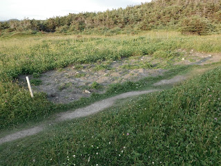
The site of the light keeper's garden.


Lobster Cove. The families who lived here were resettled during the resettlement period in Newfoundland. Now there is a road .... but no one has moved back.